Pen-y-Ghent
A Circular Walk
Pen-y-Ghent is one of the famous Yorkshire Dales 3 Peaks. At 694 metres or 2,277 feet above sea level it is the smallest of the three but, in my opinion is the most dramatic in appearance. This circular walk takes us from our starting point in the valley bottom on a steady climb to the foot of the southern ascent. From here the climbing is much steeper but rough-hewn steps ease the going a little. The final climb to the summit is a fairly easy scramble at first, followed by a steady climb to the trig point. The way down is quite steep and rough under foot at first but then becomes a gentle descent leading us to a bridleway and our return to Horton.
Here is my impression of the Pen-y-Ghent circular walk, made in the company of, and with much help from, my son Dave.
From wherever you decide to park up, the route we followed goes anticlockwise and leaves Horton near St Oswald’s church opposite The Golden Lion Hotel. Following the main B6479 road around the church turn left into School Lane, which is the second on the left after the church and is the lane after crossing the bridge.
Making a lovely start to the Pen-y-Ghent walk is the stroll along School Lane towards the tiny hamlet of Brackenbottom. This little-used lane follows the banks of a tiny, tumbling beck that rises in Douk Ghyll Scar above us. Burbling its way down the hill it passes under the Horton Bridge behind us, on its short journey to join the River Ribble.
The day of our attempt to climb Pen-y-Ghent turned out to be a gloriously mild Easter Monday. Welcome sunshine streamed down from a deep-blue sky, through newly-clothed trees lining the beck. Dotted here and there with just a few fluffy white clouds, the sky promised a fine spring day.
With the help of my recently acquired digital hearing aids I enjoyed the chirping of the birds and the chuckling of the cascading water. For years I’ve been deprived the upper spectrum of sound and now, these seemingly commonplace country sounds are a joy.
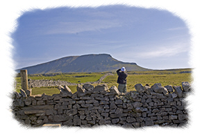
We follow the lane as it turns away from the beck and starts to rise a little more steeply towards the first buildings of Brackenbottom. Here we turn left through the small gate and head for another small gate along the farm track. Through this gate the way turns left and follows the dry stone wall climbing steadily.
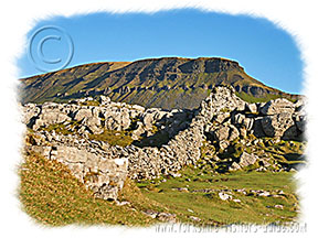
The path is well worn alongside the dry stone walling and we have no doubts about the way after passing Brackenbottom Scar. As we walked School Lane Pen-y-Ghent would pop into and out of view, as if enticing us. But from here its massive bulk dominates the view.
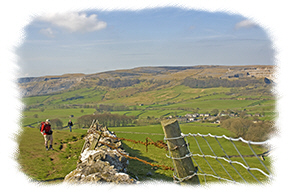
Eventually our path meets up with the Pennine Way near the foot of the southern ascent at Gavel Rigg. Ahead and behind are distant views across moors and hills. Looking south we can see the well-defined route of the Pennine Way as it climbs towards us.
Back now to the task in hand and to my eyes the way ahead promises to be a real hard slog. As we climb the stone steps I’m amazed how quickly the sharp drop to the right increases and I feel the wind on my face as it holds me pressed to the mountain side.
Puffing and panting I desperately need a rest and sit on a rock to the side of the path while Dave, as patient as ever, joins me. The cheerful “Hello!” of a passing young family of four delights me. A chuckle brightens my face and lightens my spirit as I realise the little girls are only five and seven years old. If they can do it then I’m not giving up!
Eventually we reach the top of the steps and the walking is easier until we reach a line of rocks and boulders seeming to bar the way to the top.
“This is where we do a bit of scrambling dad” Dave announces.
I’m sure he didn’t mention that before we set off! As he pointed out the way I guess I rose to the challenge. Soon we are on the last stage to the summit. The gently rising path is a relief after the exertion of the steep bits. On either side the ground falls away, gently at first, but then with a steep drop. Coming abreast of the trig point I follow suit as Dave dutifully pats it for good luck.
Set into each side of the wall are two rough and ready arbours that would surely provide welcome shelter from the wind. But today the sun is shining, the wind is light and dozens of people are taking refreshment, sitting in clusters on the grass. Finding a clear spot we join them and tuck in to sandwiches and hot tea from the thermos.
What a view! Over to the west lies Ingleborough, second in height of the 3 peaks. While further away to the north-west is the bulk of Whernside, the highest.
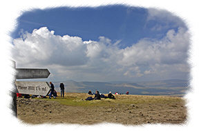
Fully refreshed and feeling just a bit proud of myself I suddenly remember we still need to get back down and back to Horton. With a brief pause for some photos we begin the descent. Still following the Pennine Way the path falls steeply and we need to watch our footing. But soon we follow the side of the mountain on a gently downward sloping path to Pen-y-Ghent Side. From here it’s easy going, though hard on the muscles in the back of the legs.What a view! Over to the west lies Ingleborough, second in height of the 3 peaks. While further away to the north-west is the bulk of Whernside, the highest. Along this stretch we manage to pass our young family. By now the little four year old has persuaded dad to carry her on his shoulders. She looks tired but she still has a cheeky grin and cheerful “Hello” for us.
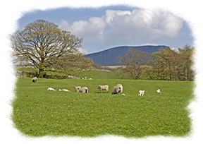
The bridleway down to Horton is a place to stride out a little to make up time lost by my need to rest awhile. It’s easy walking and I’m pleased to still be following the Pennine Way. There are sheep and their young lambs in the fields on either side. Such a lovely sight now that the foot and mouth disaster, that so cruelly heralded the new millennium, is a distant memory. In fact we follow the Pennine Way all the way back into Horton. For the final leg to the main road the bridleway turns west. It’s good to look over my shoulder for the view of Pen-y-Ghent.
Wow! Have I really been all the way up there?
